Finding Your Way: Natural Navigational Aids
Boat trips to new, exotic locations are fun, spontaneous, and easy to enjoy—especially when your GPS is there to help you get back home!
Without that handy technology, however, we wonder: could we find a way to get around?
That’s the question we’re asking in today’s blog, as we explore the natural navigational aids that have been guiding seafarers for, well, about as long as they’ve been around! Take a look.
Underwater markers
Swimming, snorkeling, or scuba diving? While you typically won’t be too far away from land or the boat that took you out, it can always help to know which way is which while under the water. A simple way to do this is to look at the ridges in the sand below the surface. As waves push toward the shore, they will leave indentations in the sand that run parallel to the shore. Once you spot those, and you want to get back to shore, you know to swim perpendicular to them to get back.
Swimming with shadows
Without costing a penny or taking up any physical space, shadows are somehow among the most helpful of navigational markers. Even without a compass, you can find your way north by observing the shadow of a rock, tree, or other structure at different times of the day. Before noon, the shadow will fall west; later on, as the sun begins to dip toward the horizon, the shadow will fall eastward. With that knowledge, you can easily reorient yourself and find your next destination.
Puddle deduction
Puddles may seem mundane—but they, too, can offer unique insights on your navigational journey. Pay attention to the ground as you walk along the beach or lakefront nature path. Is one side or section of the ground wet, while the other seems completely dry? That might signal the path of the sun, since it’s had a chance to warm up one part of the path but not the other.
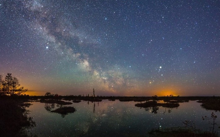
Look to the skies
Finally, one of the oldest (and most trusted) navigational aids in the book: the skies! Long before they had GPS technology, the world’s earliest seafarers and explorers would use the skies (specifically, the North Star) to light their way and point them in the right direction. You can identify the North Star for yourself by locating the Big Dipper, then following a line from the “scooped” part of the constellation to the tip of the handle of the Little Dipper. That tip is your North Star, and it will help you orient yourself and follow the path north.
Heading out with GPS technology is always a smart idea—but don’t be afraid to try these natural tools, too! They give you a fresh new way to see your surroundings, to rediscover waterways both old and new.
Bookmark & Share
Previous Article